

Our evaluation of the application of the DQF Housing and New Streets Design Guides has shown that non-compliance with the criteria in these guides consistently results in significant planning delays (4 to 20 weeks) and additional design work when schemes need to be re-designed several times in order to achieve compliance. By following the best practice advice on this page, developers can ensure a speedy and smooth planning process.
A GOOD DESIGN PROCESS
When appraising schemes in pre-application and planning stages, Nottingham City Council needs to understand how designers thought about placemaking. Here is a step by step guide of how we think best designs are achieved:
Identify key assets: existing trees, views, level changes, links, access points, etc.
Maximise key assets: shown in a diagram what you are retaining/incorporating and how you are integrating these to the design.
Set the street structure: define main access points and the street pattern and hierarchy and how this will work with water management systems, avoiding dead ends as much as possible. Look at the New Streets Design Criteria to become aware of how to achieve a good street hierarchy by managing dimensions and street types. Decide what will be adopted by the Highways authority and what will be private; Nottingham City prefers to adopt as much as possible. This is also the time to think about drainage; Nottingham prefers sustainable drainage systems.
Locate green/recreation spaces: preferably in a central zone so that these are accessible to all and form the heart of the community. Think about equipping these spaces with natural play elements, benches, areas of shade, footways, etc.; a large grass field will not suffice.
Group dwellings in parcels: achieving a density that is adequate for the context and making sure the grouping method results in an efficient use of land to achieve larger useful and productive green/recreation spaces. Look at the Housing Design Criteria to ensure gaps, frontages, parking etc are the right size.
Consider services: Illustrate waste collection routes and points, communal bin storage etc. Nottingham City prefers bin collection from the front of the property (in dedicated storage) rather than bins located in rear gardens, especially for terrace housing.
Create character: combine landscape and architecture to create diversity within the development; create end views positioning key buildings at the end of streets; ‘walk’ the site in your mind imagining what it would feel like being there and amend the design if necessary.
Think about placemaking: defining the key details that will make places work for people, such as traffic calming, making green-blue features accessible and enjoyable, places to meet, places to play, bringing nature and wildlife into the site, foraging opportunities and so on.
2. GETTING THE BASICS RIGHT
Street hierarchy


Nottingham City Council has worked across departments to co-create six core types of streets that capture the feel and character of the historic city whilst being functional and safe for modern times.
Developers are welcomed to adopt these types with the assurance that Highways Management will accept these as viable during the pre-application and planning application stages.
Links to design and technical information:
AVENUE - MAIN STREET - RESIDENTIAL STREET - LANE - MEWS - PRIVATE STREET
Parking
Nottingham requires no more than 1 to 1 1/2 parking spaces per dwelling due to the exceptional public transport system in the city, but we recognise that developers often prefer offering two spaces for 3-5 bedroom homes and we would accept this requirement driven by market preferences. However, the DQF makes it clear that car-dominated streets are not acceptable and when necessary, applicants will be strongly advised to change their designs or face significant delays and very possibly planning refusal.
COURT YARDS: Parking in court yards is strongly discouraged and will only be considered acceptable to serve flats (one car per dwelling) and when the parking area is not adjacent or visible from the street scene.
ELECTRIC VEHICLES: Nottingham City Council requires at least one electric vehicle charging point for every parking on plot or curtilage.
Links to design and technical information: (more coming soon)
BALANCING PARKING - PARKING DIMENSIONS - PARKING AS TRAFFIC CALMING
3. HOW TO DESIGN NOTTINGHAM STREETS
Trees in the highway
Nottingham City Council will not accept trees planted in private land as part of the tree requirements for development sites. This is because there is no simple way to secure the perpetuity of trees in the long term if they are in private land.
COMMUTED SUMS: The standard commuted sum for new trees planted in public land is £1,500 per tree. This means that the developer will make a payment contribution to Nottingham City Council for the long-term maintenance of new trees. How many trees the planning department will consider adequate for a scheme will depend on the nature of the site and its setting. The number of new trees required will be agreed following a technical site assessment during the pre-application process.
TREES ADOPTION: The highways authority will not adopt trees in the highways unless they are in a dedicated tree pit as part of a traffic calming solution or to demarcate on-street parking (Fig 2). Foot-ways must be adopted, and these must be adjacent to other highway land and without different ownership strips in the middle. To deliver tree-lined avenues, it is the Parks and Open Spaces department that will adopt trees, but they request that these are planted in 5m wide verges to achieve a decent amount of growth and healthy canopy cover (Fig 1). Also see the AVENUE page to find out the design solution.
Street Materials
Nottingham City Council will not accept block paving in curves or junctions; this is due to the long-term maintenance costs they incur. The discrete use of block paving in short, straight sections of road as a way to reduce traffic speed or to demarcate character zones is acceptable if the colour palette is kept to a minimum (Fig 3).
The use of Tarmac is preferred in Nottingham, used in combination with granite sets when defining boundaries or to aid placemaking, place character and/or zone demarcation.
When Residential Streets are raised in parts to achieve areas without kerbs, on-street parking and adopted foot-ways must be demarcated with inset materials such as stone or block paving (not paint), fitted at surface level (Fig 4).
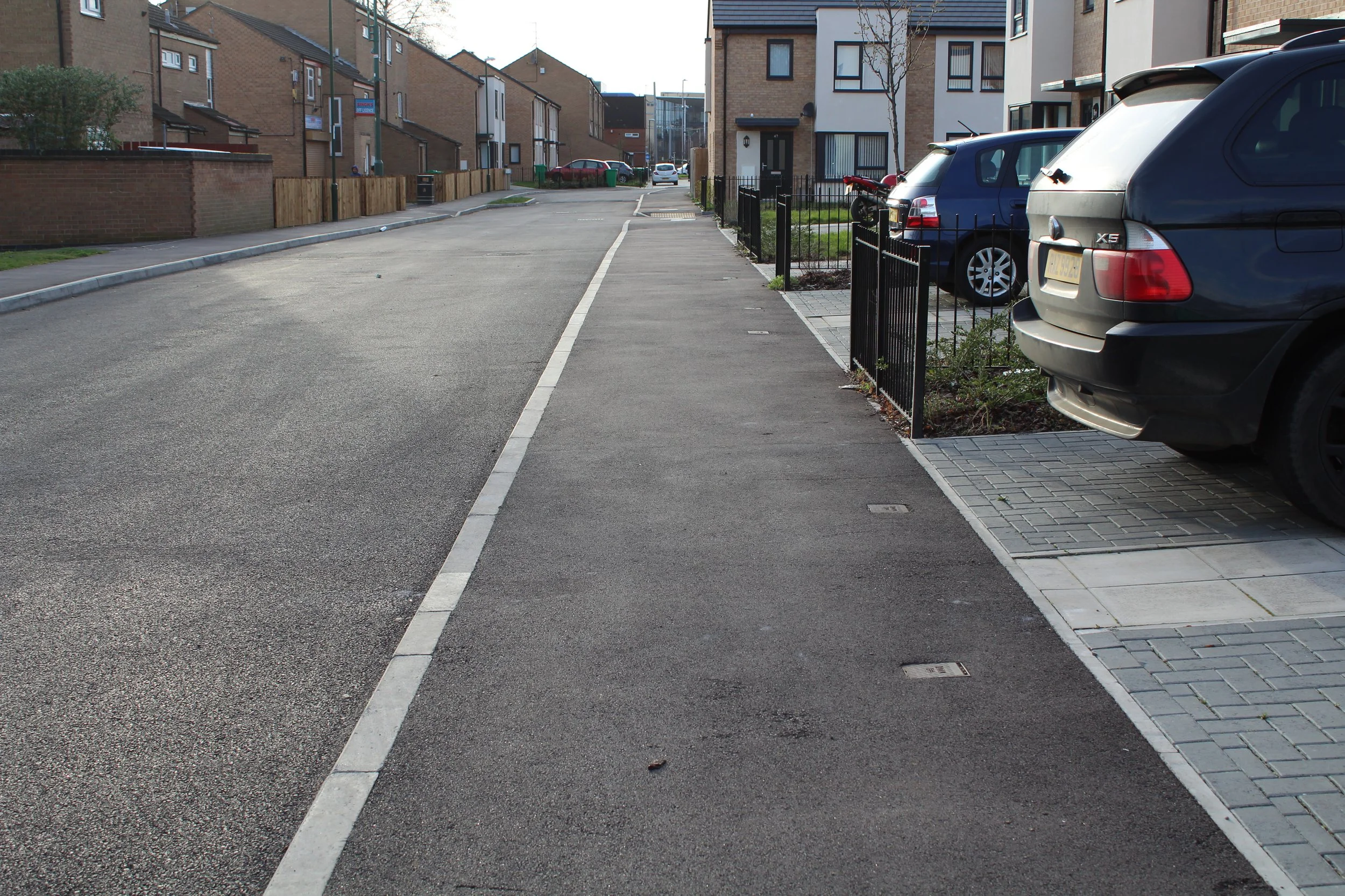
Fig 4: Flush insets on Tarmac to demarcate foot-way and private curtilage parking.

Fig 5: Example of soft speed control measure using different materials in combination with tree pits.
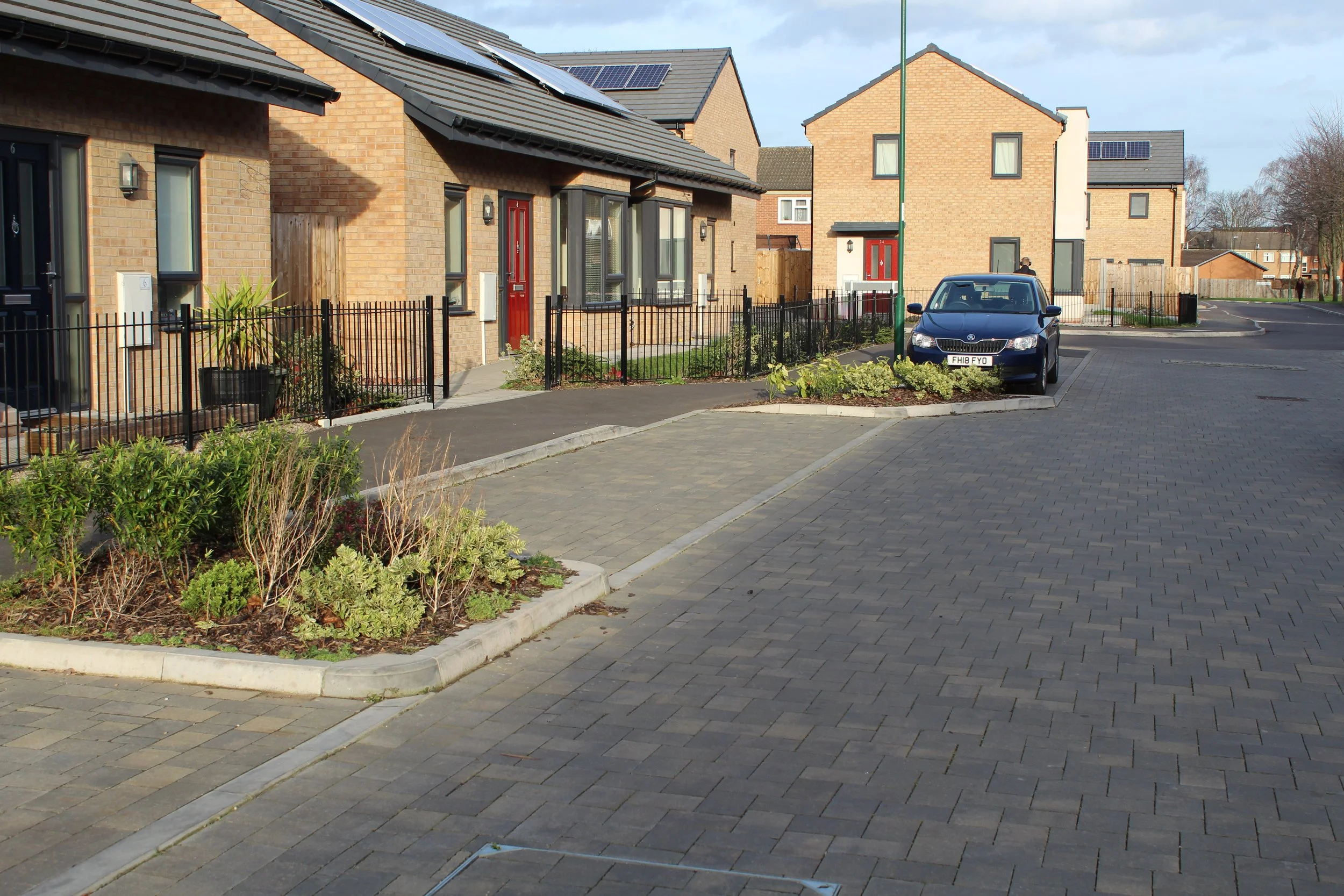
Fig 6: Traffic calming solution combining planters and designated on-street parking.
Traffic calming
Nottingham City Council advocates natural traffic calming measures. Although the use of speed cushions (or bumps) might be necessary in specific locations, the authority prefers softer measures like adding chicanes, raising whole sections of the street (Fig 5), using trees and planting or locating demarcated street parking to indicate drivers they need to slow down (Fig 6).
Crossings and junctions
Crossings and junctions should always prioritise pedestrians in residential areas. Although it is preferable to design raised pedestrian priority crossings (see Figs 7a and 7b), there are times when this arrangement is not possible and a more formal approach such as zebra or traffic light crossing is necessary, particularly when there are high volumes of traffic to consider. If a raised crossing is not feasible, the Highways Management team will advise the best approach on crossings and how to consider parking on/off busy roads or main streets after they had chance to evaluate the technical site assessment during the pre-application or planning process.
Services
The inclusion of services must be an early consideration during the design stages to avoid impact on placemaking features like street trees and the quality of the movement network. Nottingham City Council will not accept dedicated service strips, especially is these are raised or designed in ways that confuse pedestrians.
Consider the location of lampposts and trees in tandem to avoid clashes, for example, canopies that might need to be trimmed or reduced to avoid poor illumination in the future.
Water management
Nottingham City Council advocates SuDS systems that create quality, natural environments in residential areas. Water management must be considered from the outset and any strategy/feature incorporated must be an integral part of the design, contributing to placemaking and the overall amenity of the place. Some critical information can be found in our Drainage Guidance; the Flood Risk Management team will advise on the design details during the pre-application stage.
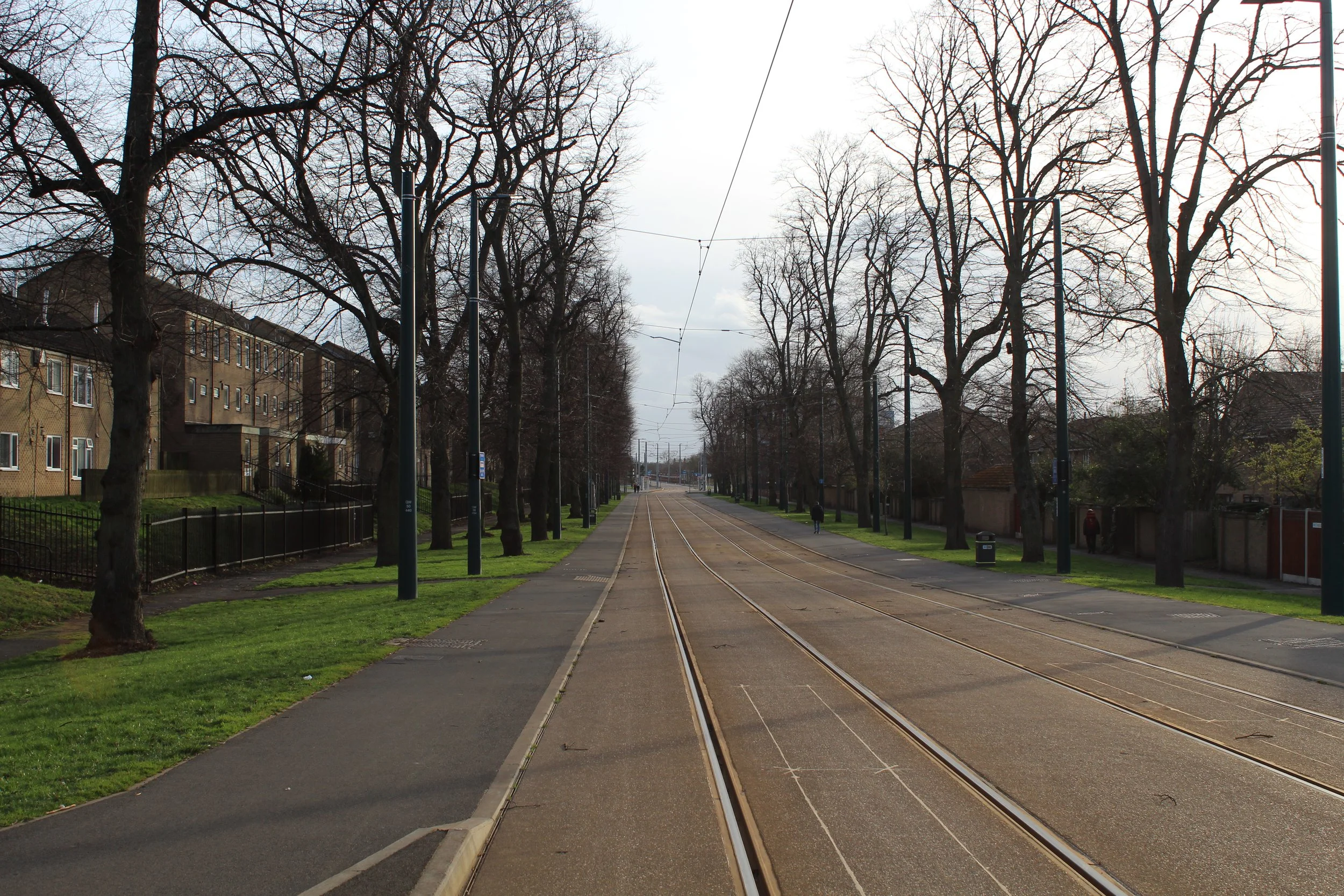
Fig 1: Highways adoption of foot-way adjacent to tram line with separate verge adopted by Parks and Open Spaces.

Fig 2: Use of tree (in pit) to aid traffic calming also demarcating on-street parking.

Fig 3: Use of block paving in a straight part of a street (and Tarmac in the curve).

Fig 7a: Example of continuous foot-way pedestrian priority crossing in London (courtesy of PJA).
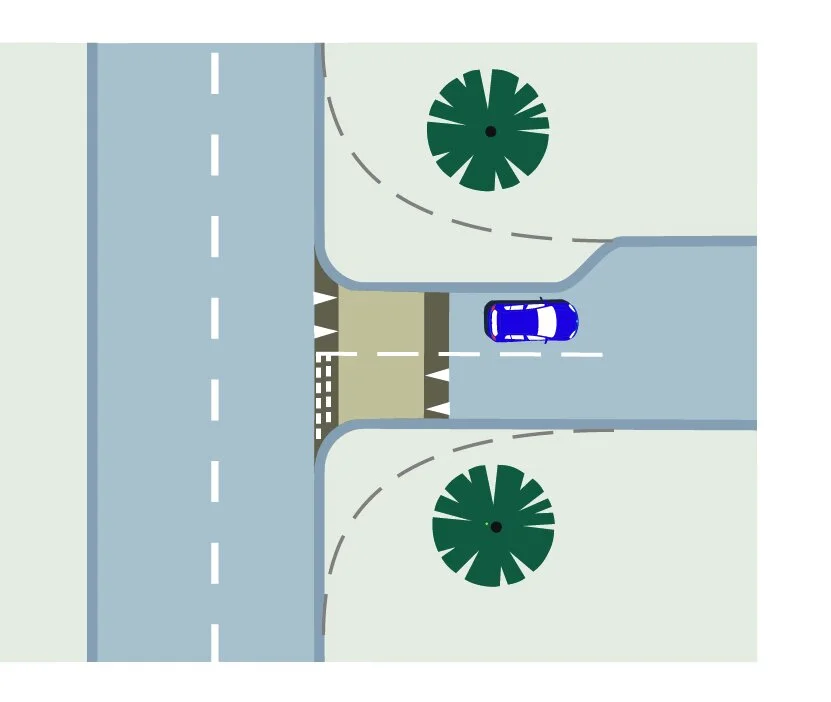
Fig 7b: Example of continuous foot-way pedestrian priority crossing in London (courtesy of PJA).

Fig 8: Poorly designed service strips like the one shown in this photo must be avoided.